-
-
-
-
-
The Canal's Past
-
-
-
-
-
-
-
-
-
-
-
-
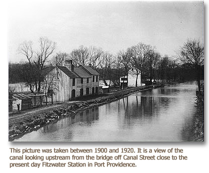
The canal’s original name was Oakes Reach. A "reach" is the flat water of a canal between two locks. Thomas Oakes was the navigation company’s first principal engineer, and the canal’s designer in 1820. Both Oakes and his successor died a few years later from the "plague" that swept field crews working on the navigation under primitive conditions that can only be imagined today.
The history of the Schuylkill Canal reflects that of the navigation as a whole. It originally flowed for three and a half miles from Lock 60, just below Black Rock Dam (which still stands), past the settlements of Quincyville (now Mont Clare) and Jacobs (later Lumberville), to Lock 61 at Oaks, where it entered the upriver end of the dam pool created by Pawlings Dam and the junction of Perkiomen Creek and the river.
By the 1830s growing boat traffic caused the Schuylkill Navigation Company to want to double Lock 60. To do so, the original Lock 60 was removed and two lock chambers side by side were built a little farther downstream where the canal was wider. By the 1840s the new wider boats required wider locks, and in 1846 the company rebuilt the eastern lock as a chamber 18 feet wide and 110 feet long. This grand lock contrasted greatly with the small western chamber, which was only thirteen feet wide.
The entire area began to grow too, supported by the hundreds of passing boats. Lumberville in particular flourished. It was the only stop between Norristown and Pottstown, and offered stabling for mules, a general store, a chapel and boat supplies. It soon changed its name to Port Providence. Quincyville, too, grew after the 1840s, when a wooden covered bridge was built across the river and canal, connecting the village to Phoenixville and replacing a ford. By the 1880s, when the Pennsylvania Railroad came through, it was made a train stop. The railroad renamed the village Mont Clare, after an estate, "Montclair," uphill from the river—to the dismay of old Quincyville residents.
After the collapse of commercial traffic in the navigation in the 1920s, the old canals were much used for recreation. Pleasure boats took people on excursions from Philadelphia to Reading, and in Port Providence and Mont Clare almost every back yard had a small dock in the canal for a canoe or rowboat. But about 1950 the dredging of a hundred years’ accumulation of coal silt from the Schuylkill began, and Oakes Reach became a mile shorter. Its lower mile, between Port Providence and Oaks, was used as an impoundment basin for the vast amount of silt dredged from the river. This basin can still be seen, surrounded by a berm. Today silt from other impoundment basins along the river is brought to the site and recycled as fuel for the third world. The canal now ends at Longford Road, where a small stream enabled the Army Corps of Engineers to construct an outflow. The stream takes the water back to the Schuylkill.
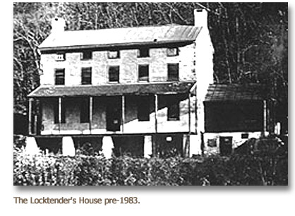
The state retained a superintendent in the Locktender’s House until his retirement in the early ‘70s. After that the area was neglected and the Locktender’s House was boarded up. The towpath became overgrown and the two remote ends of the canal, at the head and the foot, quickly became havens for dumpers and gangs. The Locktender’s House was vandalized inside and out. And the other canal structures fell into disrepair. In 1980 the state, wishing to wash its hands of the whole canal area, invited Upper Providence Township to lease Oakes Reach, and gave the township to understand that it would otherwise simply fill in the canal.
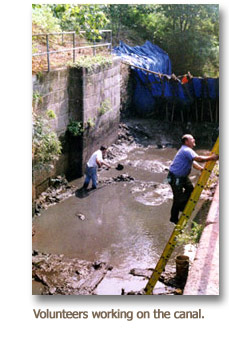
But the canal meant a great deal to the people who lived around it. The township supervisors created a Schuylkill Canal Advisory Committee of local citizens to explore how the canal might be saved without great taxpayer expense. Committee members quickly organized widespread community support for maintaining the canal with volunteers. In 1983 Upper Providence signed a 25-year lease to the area, and in 1985 the volunteer citizens incorporated as the Schuylkill Canal Association, already with some 200 dues-paying members (the current lease is with Montgomery County).
The Association devoted its energies in its first ten years to creating and maintaining a safe and attractive recreation area for the public. With a lot of volunteer labor and the help of the township and Montgomery County, the Locktender’s House was repaired and made minimally livable, and a tenant family, complete with dog, was established to keep an eye on things. Association members mowed the towpath, cleared the trails, cleaned up the grounds, built canoe launches in the canal and provided two picnic groves. In 1996, after Governor Ridge had declared the Schuylkill a state heritage corridor, the Association was awarded Montgomery County’s first heritage corridor implementation grant. The Arcadia Foundation provided the required matching grant, and in ’96 two 12-foot-wide cement plank canoe launches were built into the river, one opposite the head of the canal, the other opposite the foot. That was the first of many restoration projects that have followed, and that are still ongoing. The Association now divides its energies between its basic job of maintaining a much-used recreation area and its multi-year project of recreating a canal-era setting at the site. Its present activities are best summarized under two headings:
Recreation and Restoration.


