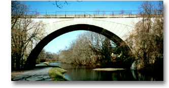
The canal itself has always played a vital role in the community.  The land below Lock 60 is floodplain. When the Schuylkill River floods, the canal is a large catch basin for the rising water, lessening the danger of flooding for the many properties that border the canal in Mont Clare and Port Providence. It is also the only source of water for fire companies to draw on in times of fire in the area. However, as a man-made ditch dug in the earth it is subject to constant deterioration. By the time SCA entered the scene in the 1980s the canal’s banks were eroded, the simple earthen berm on its river side that kept the water in its bed had serious leaks from muskrat holes and decayed tree roots, old spillways were broken, and the controls and sluice gates at its inflows and outflows were rusted and inoperable.

SCA’s earliest major investment in the canal was the construction in 1995 of a $12,000 spillway at the foot of the canal. It replaced corroded underground conduits that had been leaking for years. This was a large fund-raising achievement before the day of Heritage Park grants. Than in 2000 two storms caused two major successive breaches in the berm, both causing canal waters from Lock 60 down to drain away into the river. These events galvanized SCA to take aggressive measures to stabilize the canal’s banks, preserve its flow and control its water levels.

In the first of the 2000 storms a simple stone spillway in the lower canal, opposite Canal St. in Port Providence, gave way. The second storm opened up the weir opposite the  Locktender’s House, creating a huge opening through which all canal waters almost immediately gushed out. The old spillway was soon repaired, but making the weir function as it should was a much bigger project. The weir had given SCA trouble from the first. Reconstructed in the 1950s by DER, Bureau of Forests & Waterways, it consisted of two side-by-side underwater conduits through the berm, through which water could flow from the canal into the river. The conduits had once upon a time had a watertight gate across their canal ends that could be raised or lowered, enabling the canal’s caretaker to adjust the amount of water exiting the canal. Thus the weir had the vital function of acting as a sort of safety valve in times of flood or drought. The amount of water in the canal could be adjusted by raising or lowering the gate. By SCA’s time, however, the operating gate had long since deteriorated. SCA kept trying to fasten big plywood boards or sheets of metal in front of the gates, but they would be carried away by storms. In 2001 a PA Department of Environmental Protection Growing Greener grant provided funding to bring the weir thoroughly up to date. Modern state of the art gates are now in place, one for each conduit. They are controlled by the upright posts that are conspicuous along the towpath. The major erosion of the banks around the old conduit housing has been held at bay with rip rap. Later a Delaware Estuary Partnership grant cooperated with SCA in revegetating the further weir bank to the river. The point of land at the weir estuary is a favorite spot of fishermen.
Other improvements of the last few years have been strengthening the landside guardwall in the forebay just above Lock 60, and, at the mouth of the first ravine, providing a channel to divert excessive storm water from the stream to reduce the amount of sediment deposited into the forebay. Future plans include replacing the rusted underwater sluice gate that governs the conduit that delivers all the canal’s waters from the forebay above Lock 60 to the canal head below Lock 60. This conduit runs through the smaller of the two chambers that once composed the lock. The entire chamber is now out of sight, long buried under fill. Funding for this project is in hand, and design work has begun.
Long-range plans include a similar modern sluice gate at the outflow of the canal at its foot, where it flows into the small stream that takes its waters back to the river.


